must be made immediately to the NTSB. must be made within 10 days to the FAA. is not required.
UAV Campus | Remote Pilot FAA Exam Prep for Drones Latest Questions
UAV CampusAdministrator
stalling at higher-than-normal airspeed. a longer takeoff run. difficulty in recovering from a stalled condition.
UAV CampusAdministrator
August 31, 2021. August 12, 2021. August 31, 2020.
UAV CampusAdministrator
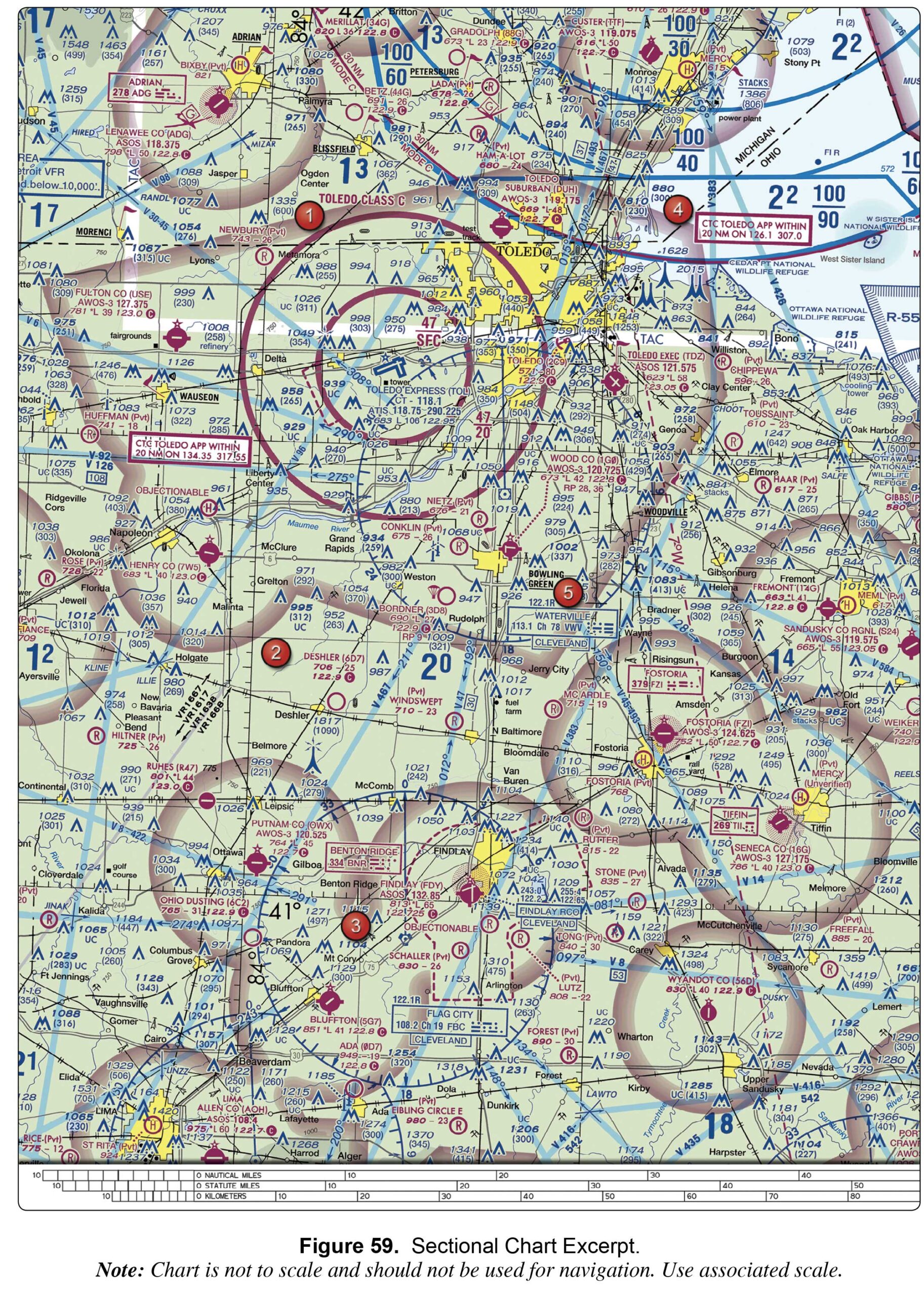
Yes, the defined route provides traffic separation to manned aircraft. Yes, this is a Military Training Route from the surface to 1,500 feet AGL and below. No, all operations will be above 400 feet.
UAV CampusAdministrator
Not so fast, think first. Do it quickly to get it over with. It could happen to me.
two quick, white flashes between green flashes. white and green alternating flashes. green, yellow, and white flashes.
UAV CampusAdministrator
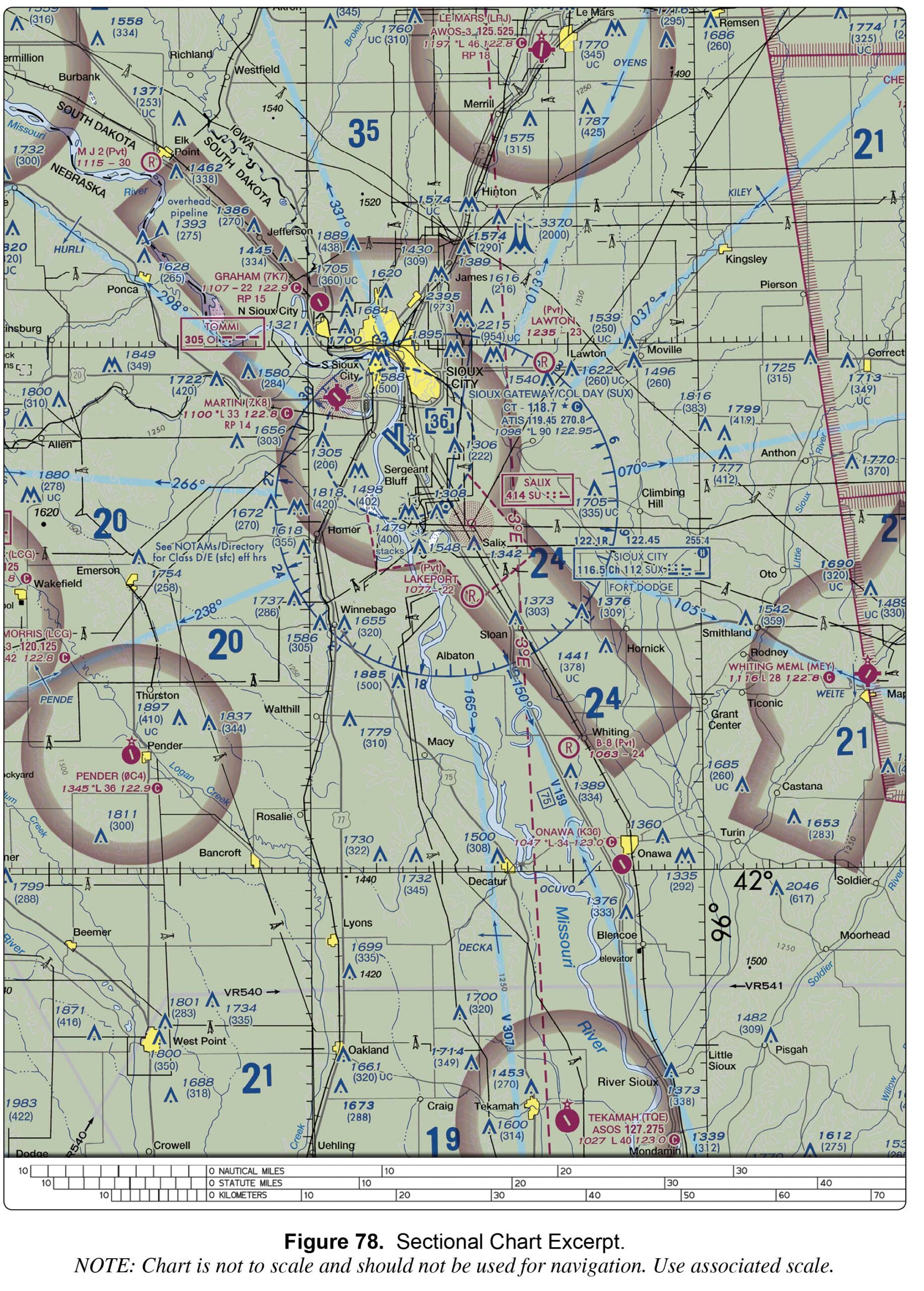
122.95 MHz. 118.7 MHz. 119.45 MHz.