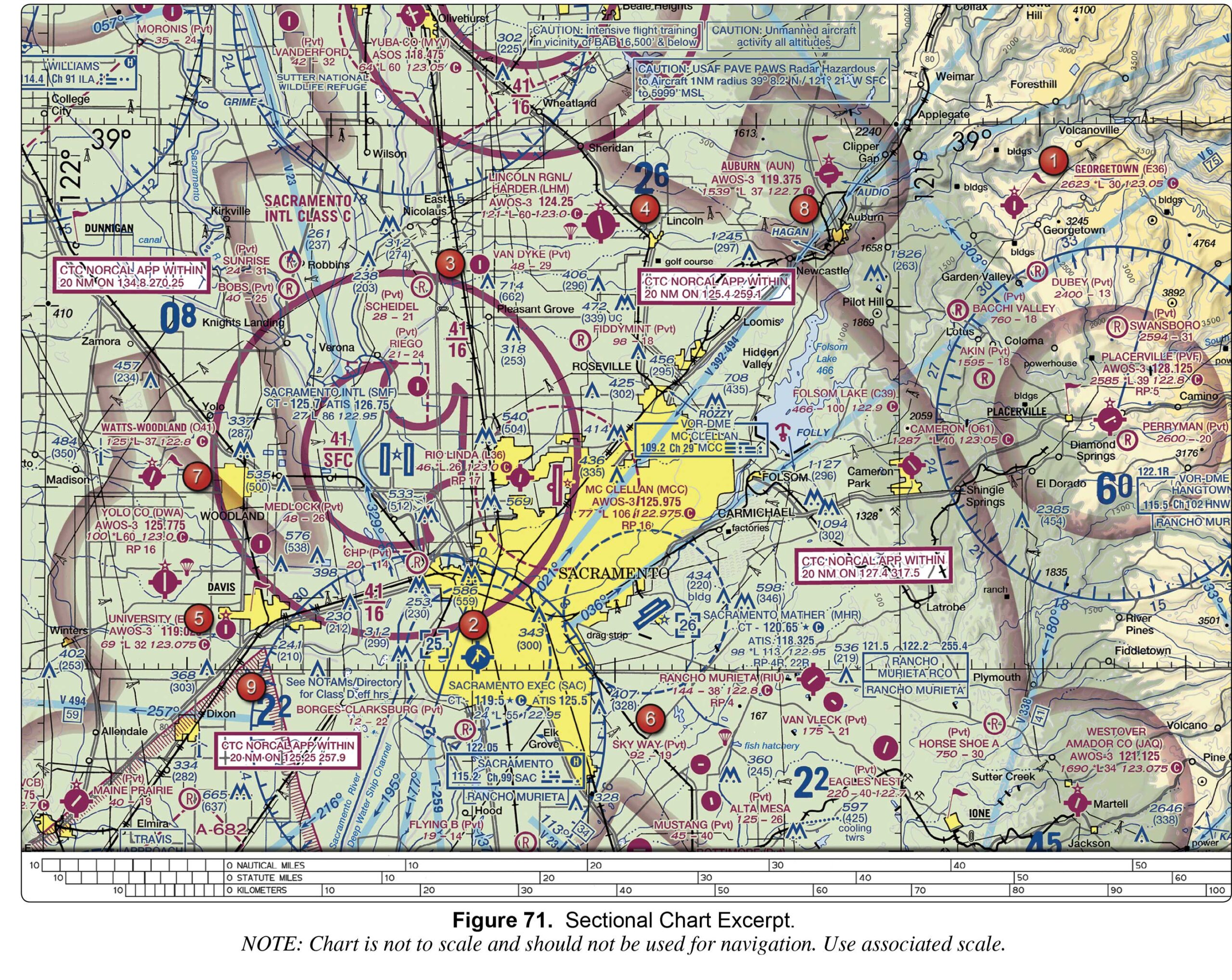
a privately owned airport restricted to use. an airport restricted to use by sport pilots only. a restricted military stage field within restricted airspace.
Sign Up to our FAA Prep for the Remote Pilot Exam. Ask questions, answer people’s questions, and connect with other UAV/Drone Pilots.
Login to our social questions & Answers Engine to ask questions answer people’s questions & connect with other people.
Lost your password? Please enter your email address. You will receive a link and will create a new password via email.
Please briefly explain why you feel this question should be reported.
Please briefly explain why you feel this answer should be reported.
Please briefly explain why you feel this user should be reported.
We want to connect you and others around the U.S. to the best FAA Remote Pilot Exam Prep. We have developed some of the best online courses that are affordable for everyone to participate in and learn from. Plus we have created this amazing Quizlet style Q&A to help you prepare for the FAA exam!
a privately owned airport restricted to use. an airport restricted to use by sport pilots only. a restricted military stage field within restricted airspace.
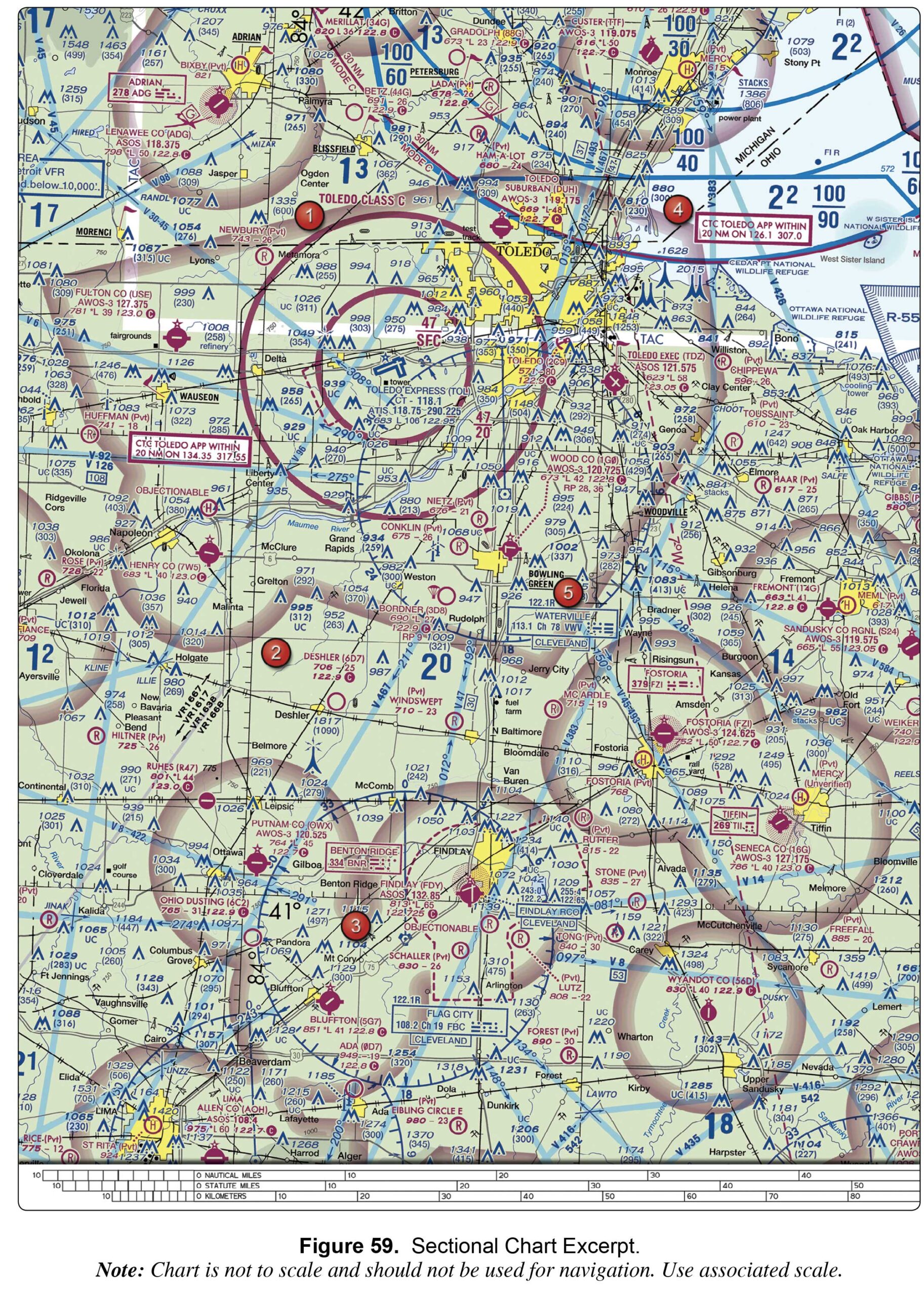
A private airport with a grass runway. An abandoned paved airport having landmark value. A public airport with a runway that is not a hard surface.
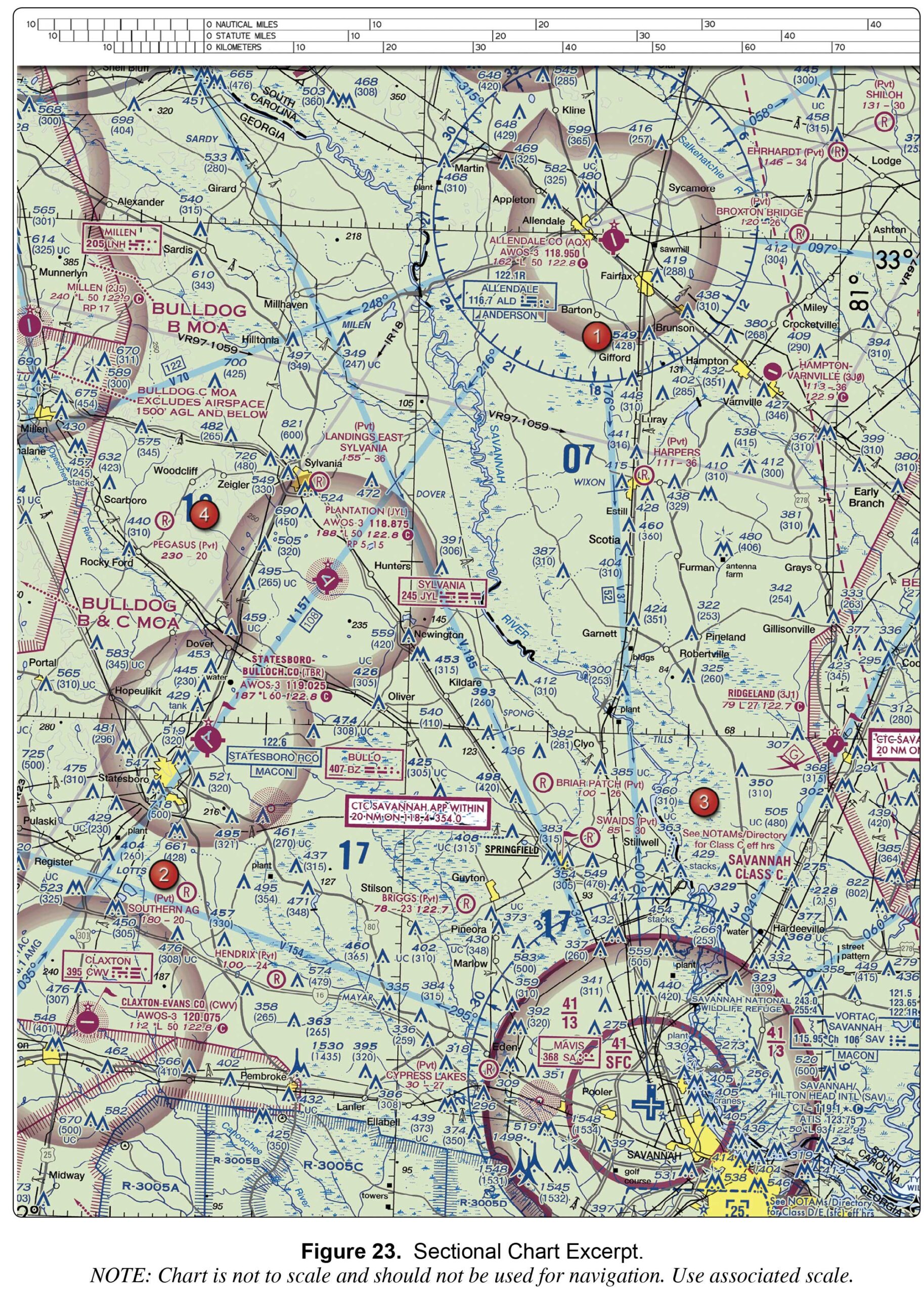
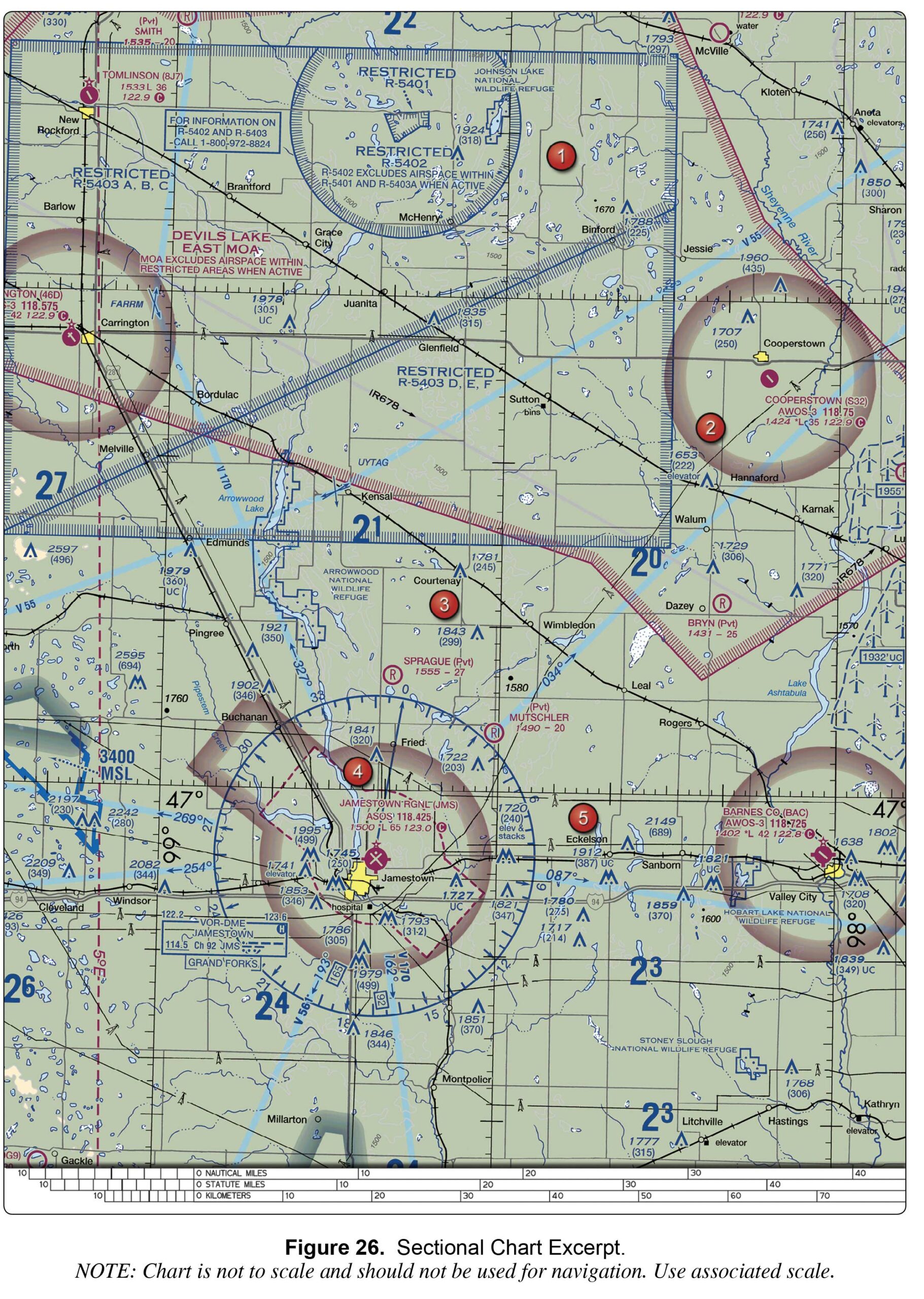
Refer to the legend for special use airspace phone number. This ...
High density military operations in the vicinity. Unmarked balloon on a ...
notes on the border of the chart. the Chart Supplement. the Notices to Airmen ...
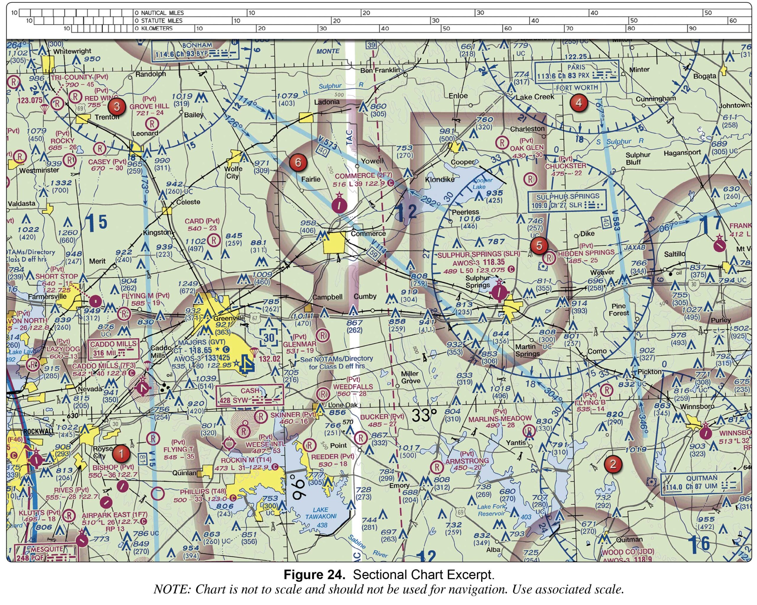
the Notices to Airmen (NOTAM) publication. notes on the border of the chart. the Airport/Facility Directory section of the Chart Supplement.
Class G airspace — surface up to but not including 700 feet MSL; Class E airspace — 700 feet to 14,500 feet MSL. Class G airspace — surface up to but not including 18,000 feet MSL. Class G airspace — ...