

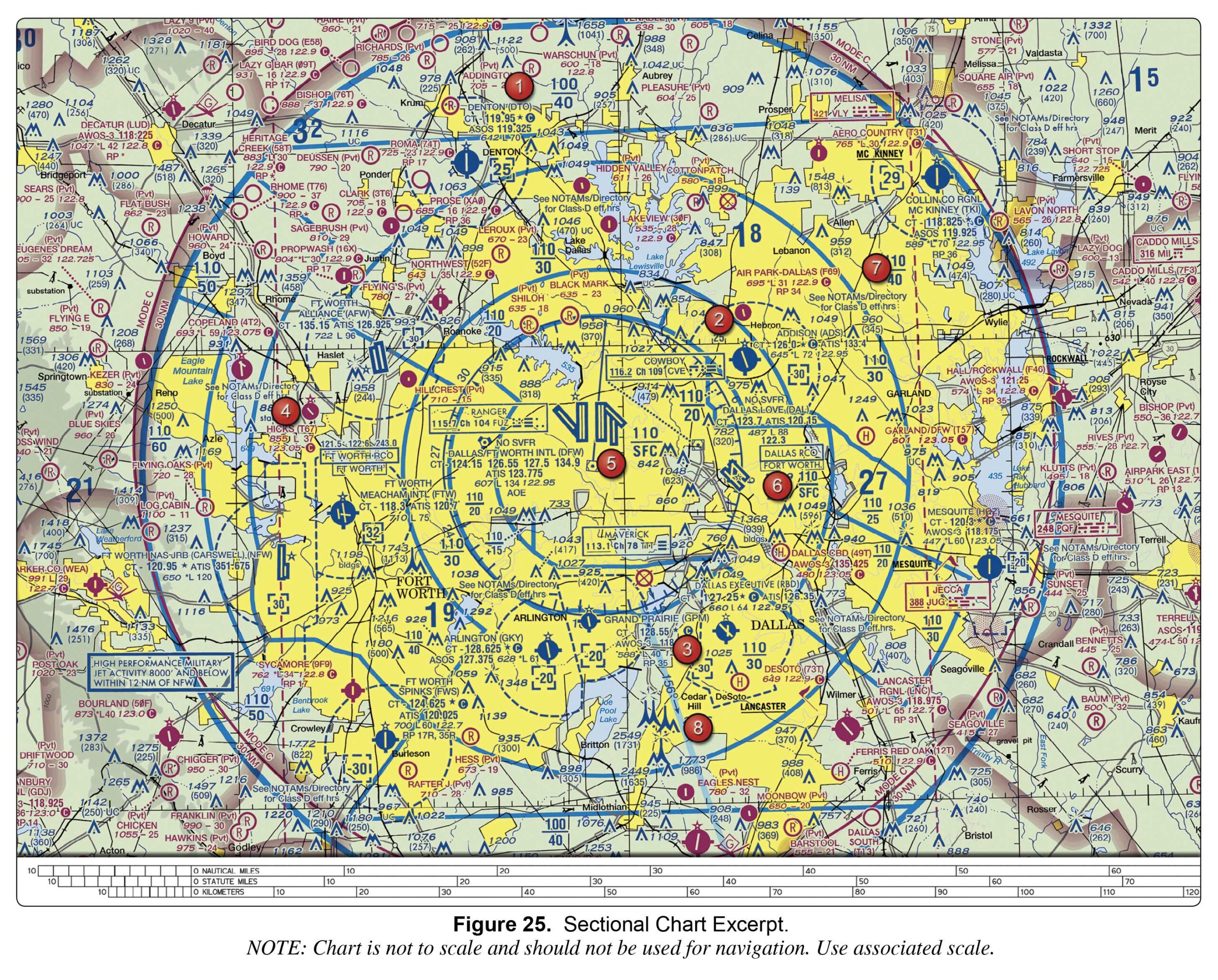
3000 1700 4000
Sign Up to our FAA Prep for the Remote Pilot Exam. Ask questions, answer people’s questions, and connect with other UAV/Drone Pilots.
Login to our social questions & Answers Engine to ask questions answer people’s questions & connect with other people.
Lost your password? Please enter your email address. You will receive a link and will create a new password via email.
Please briefly explain why you feel this question should be reported.
Please briefly explain why you feel this answer should be reported.
Please briefly explain why you feel this user should be reported.
3000 1700 4000
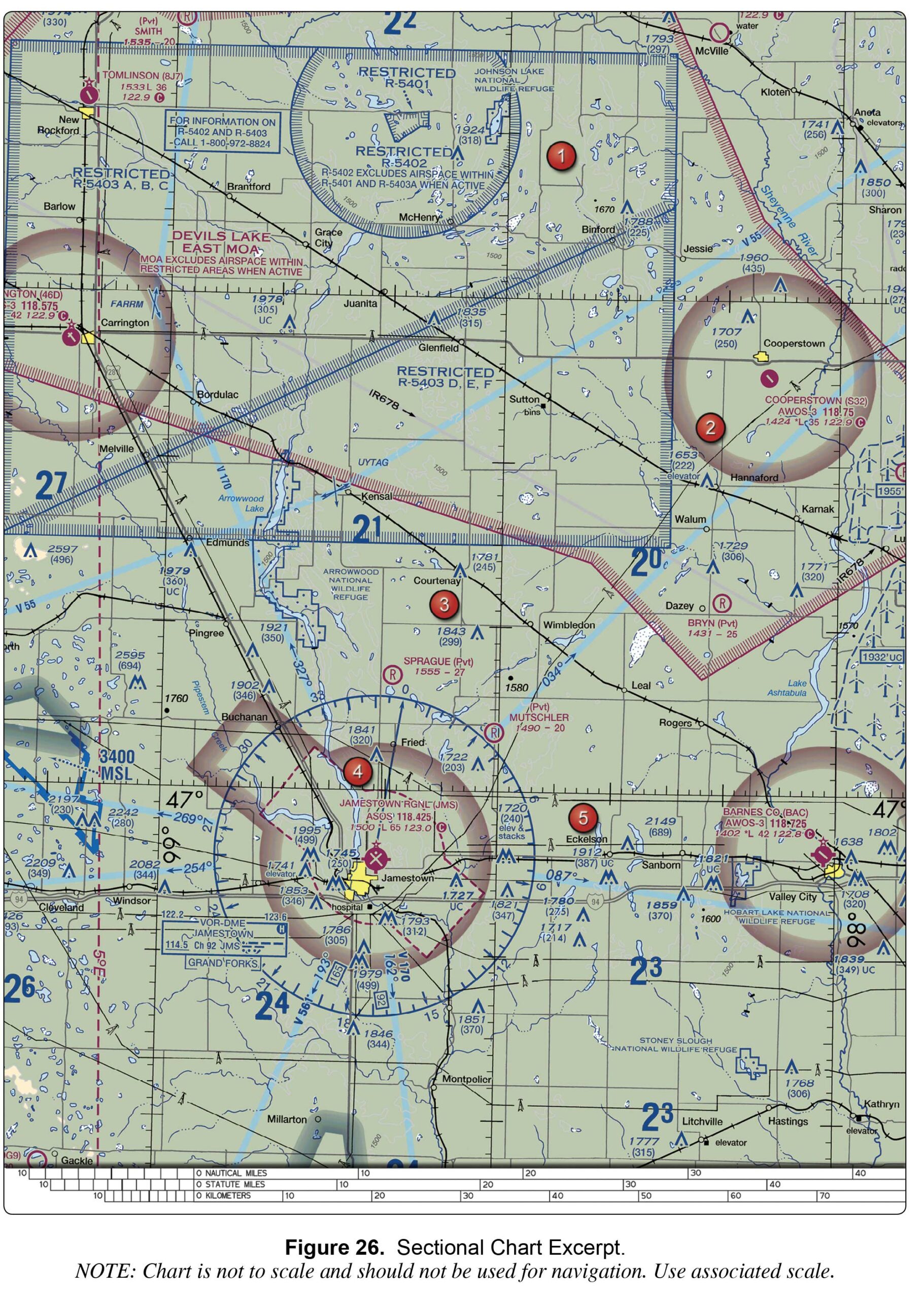
Class E airspace from the surface to 1,200 feet MSL. Class D airspace from the surface to the floor of the overlying Class E airspace. Class G airspace from the surface up to but not including 700 feet AGL.
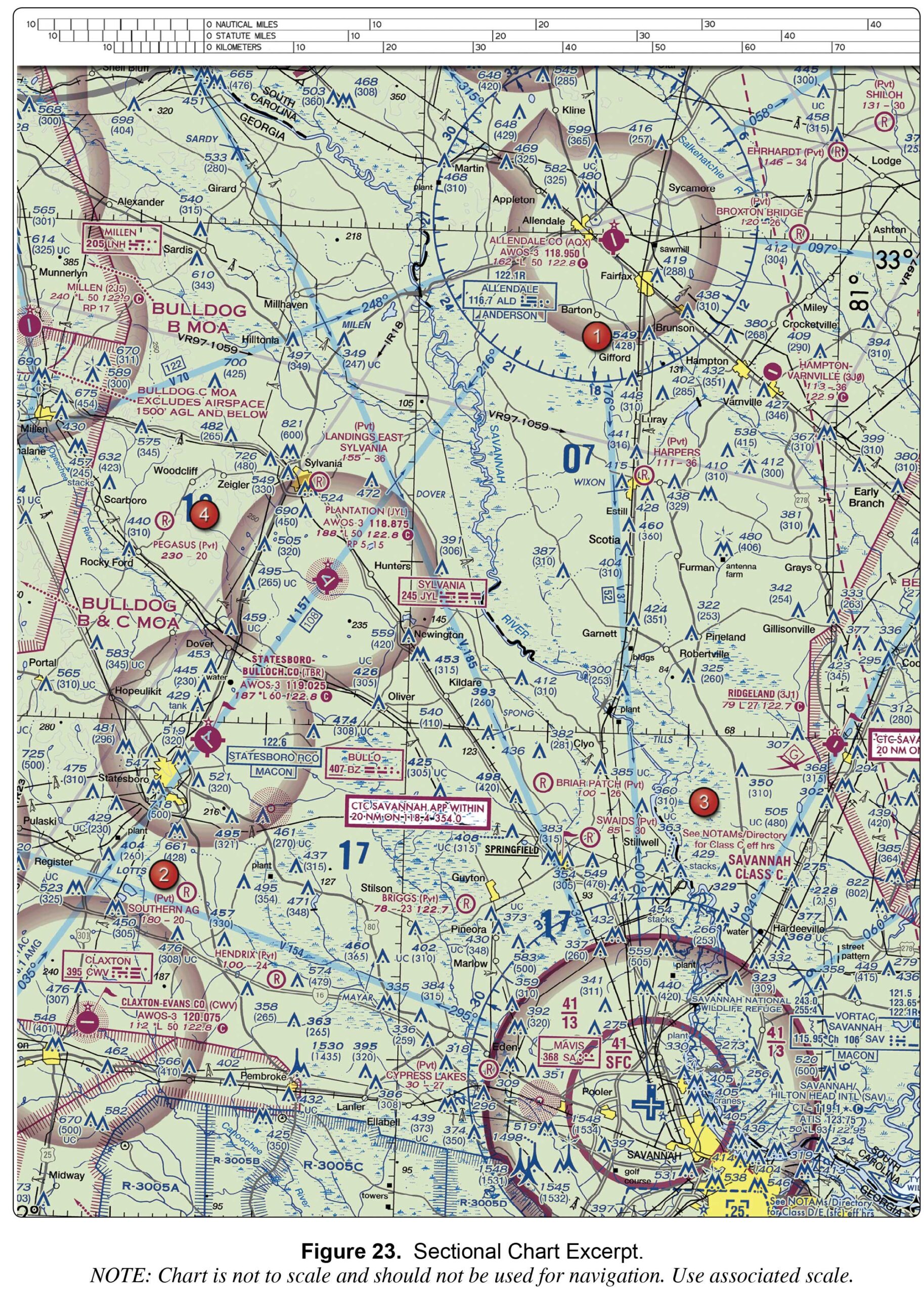
notes on the border of the chart. the Chart Supplement. the Notices to Airmen (NOTAM) publication.
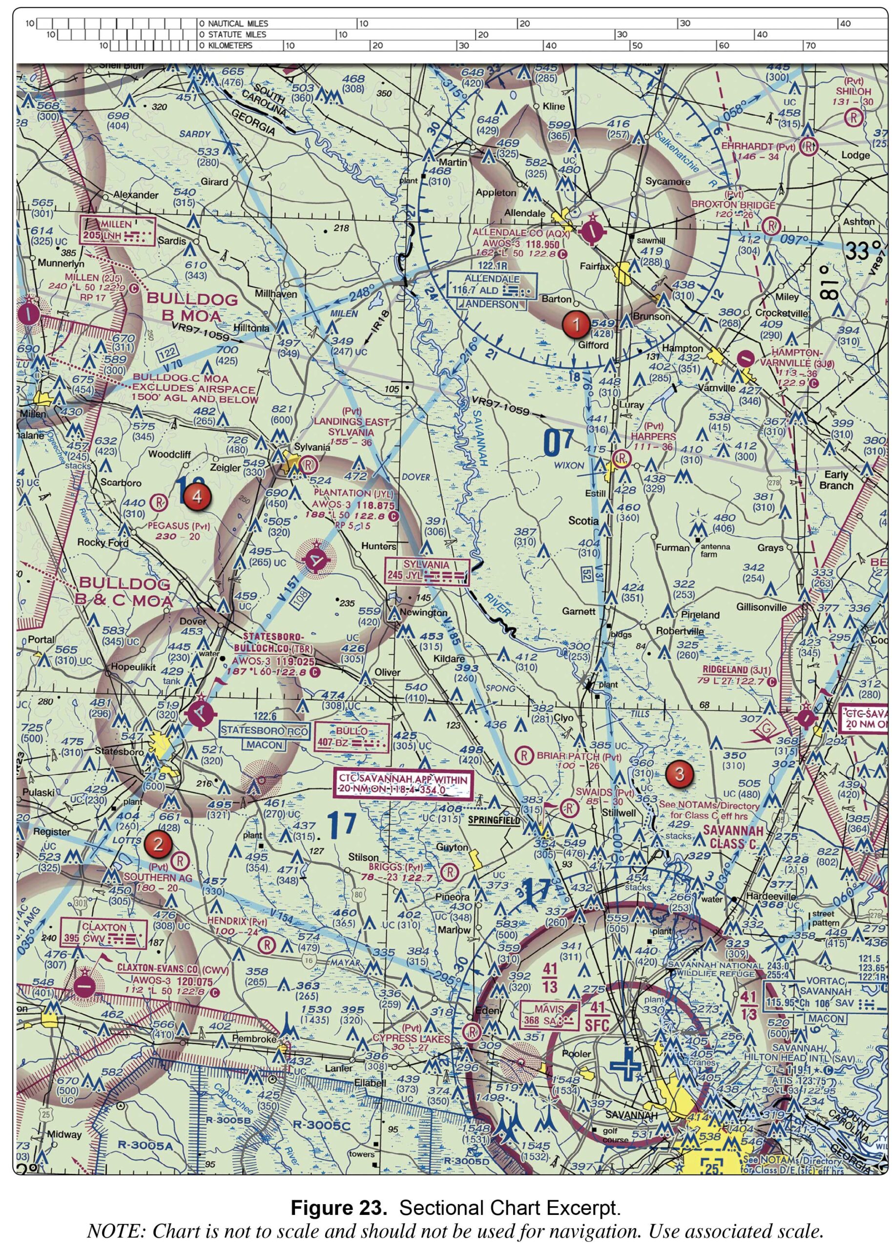
1,300 feet MSL. 1,300 feet AGL. 1,700 feet MSL.
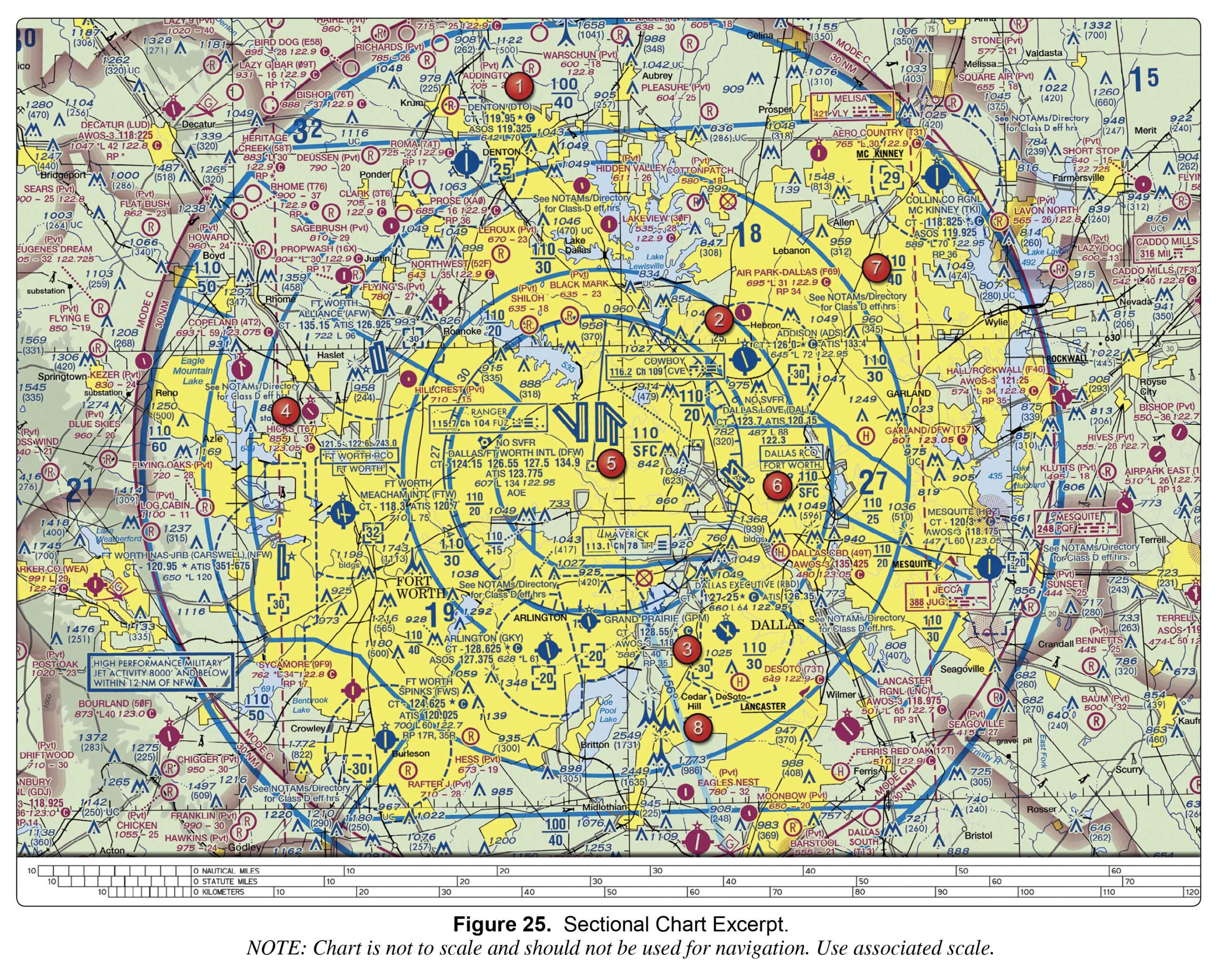
3,000 feet MSL. 3,100 feet MSL. at the surface.
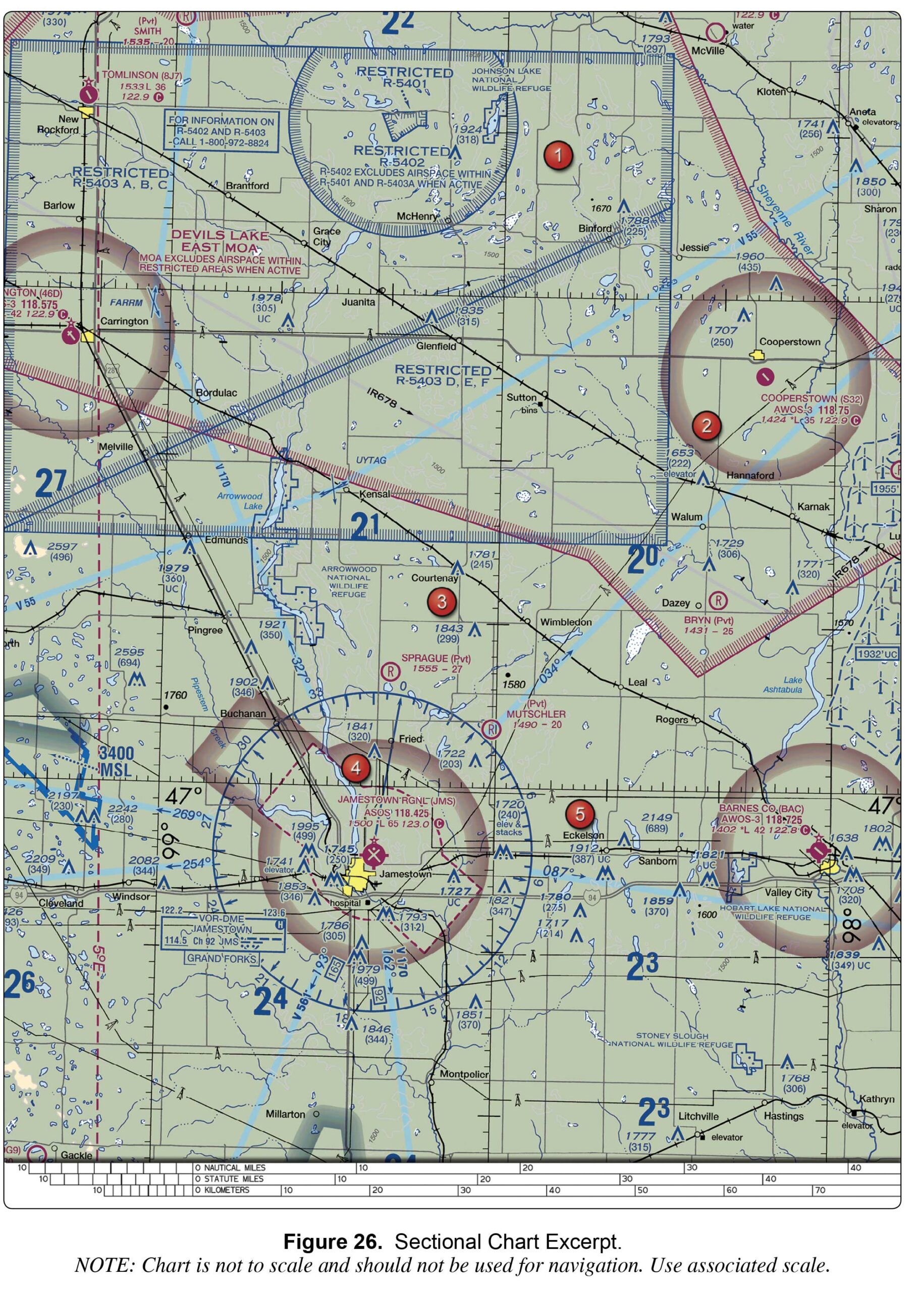
The aircraft is West. The aircraft is East. The aircraft is South.
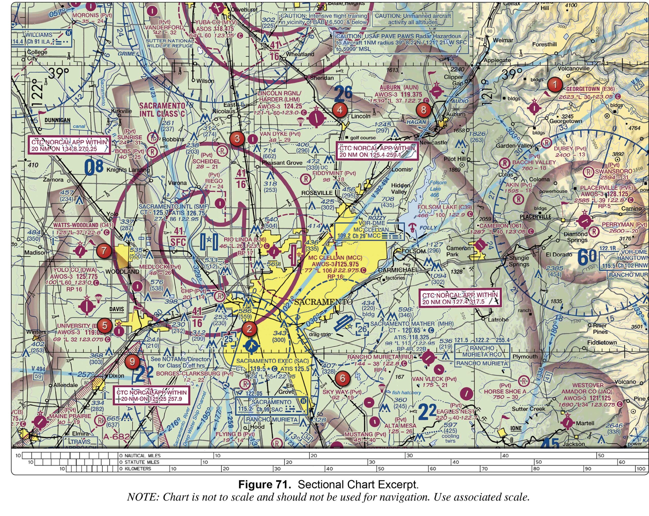
a privately owned airport restricted to use. an airport restricted to use by sport pilots only. a restricted military stage field within restricted airspace.
The flag indicates that there will be a large obstruction depicted on ...
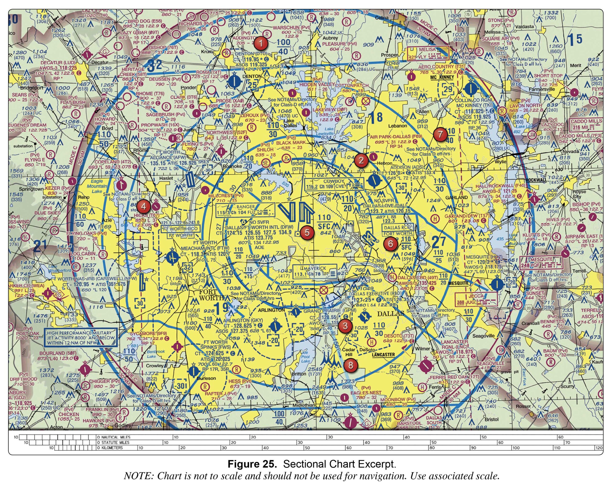
Class C airspace to 5,000 feet MSL. Class D airspace to 3,200 feet MSL. Class B airspace to 10,000 feet MSL.
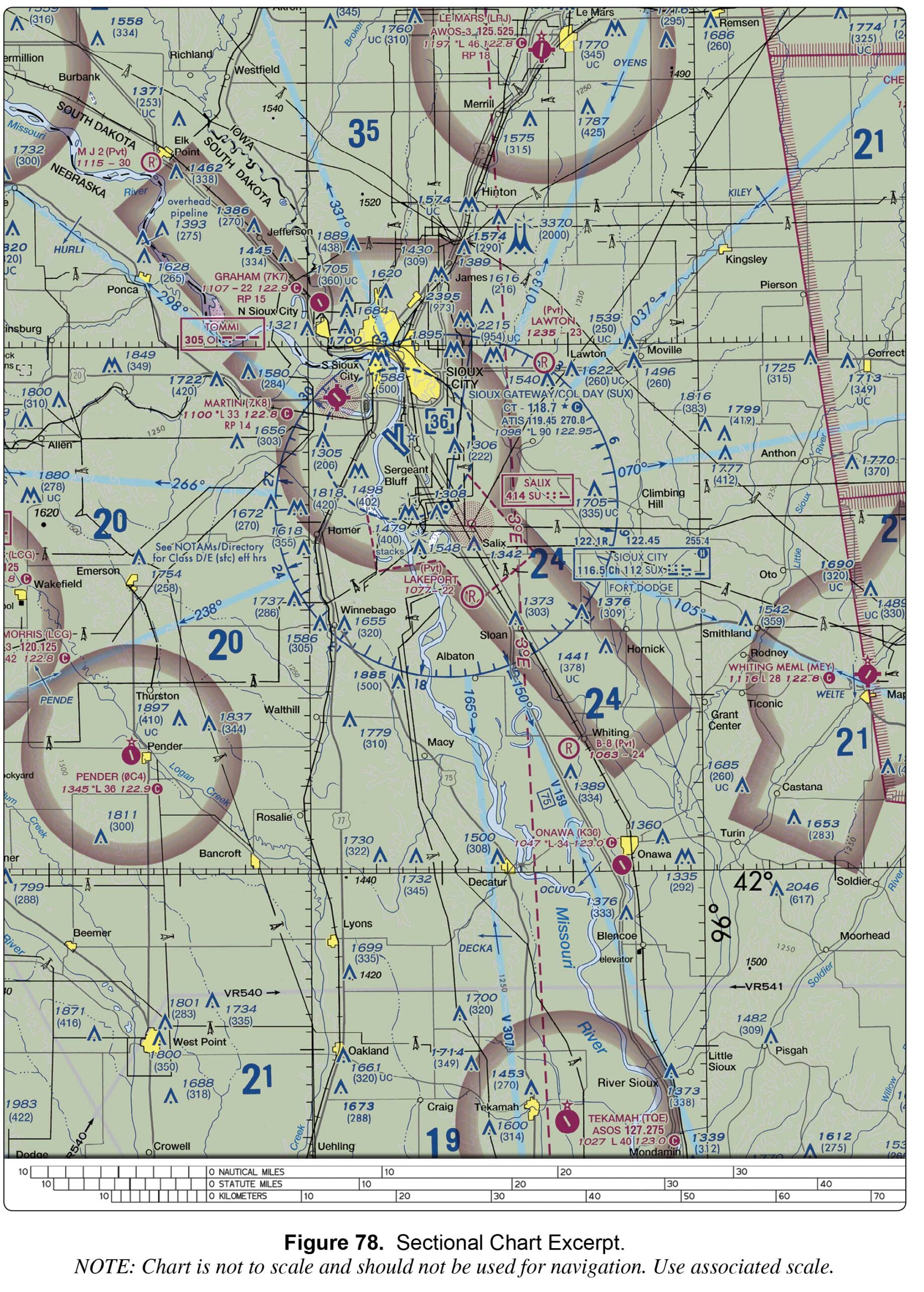
122.95 MHz. 118.7 MHz. 119.45 MHz.