The flag indicates that there will be a large obstruction depicted on ...
UAV Campus | Remote Pilot FAA Exam Prep for Drones Latest Questions
UAV CampusAdministrator
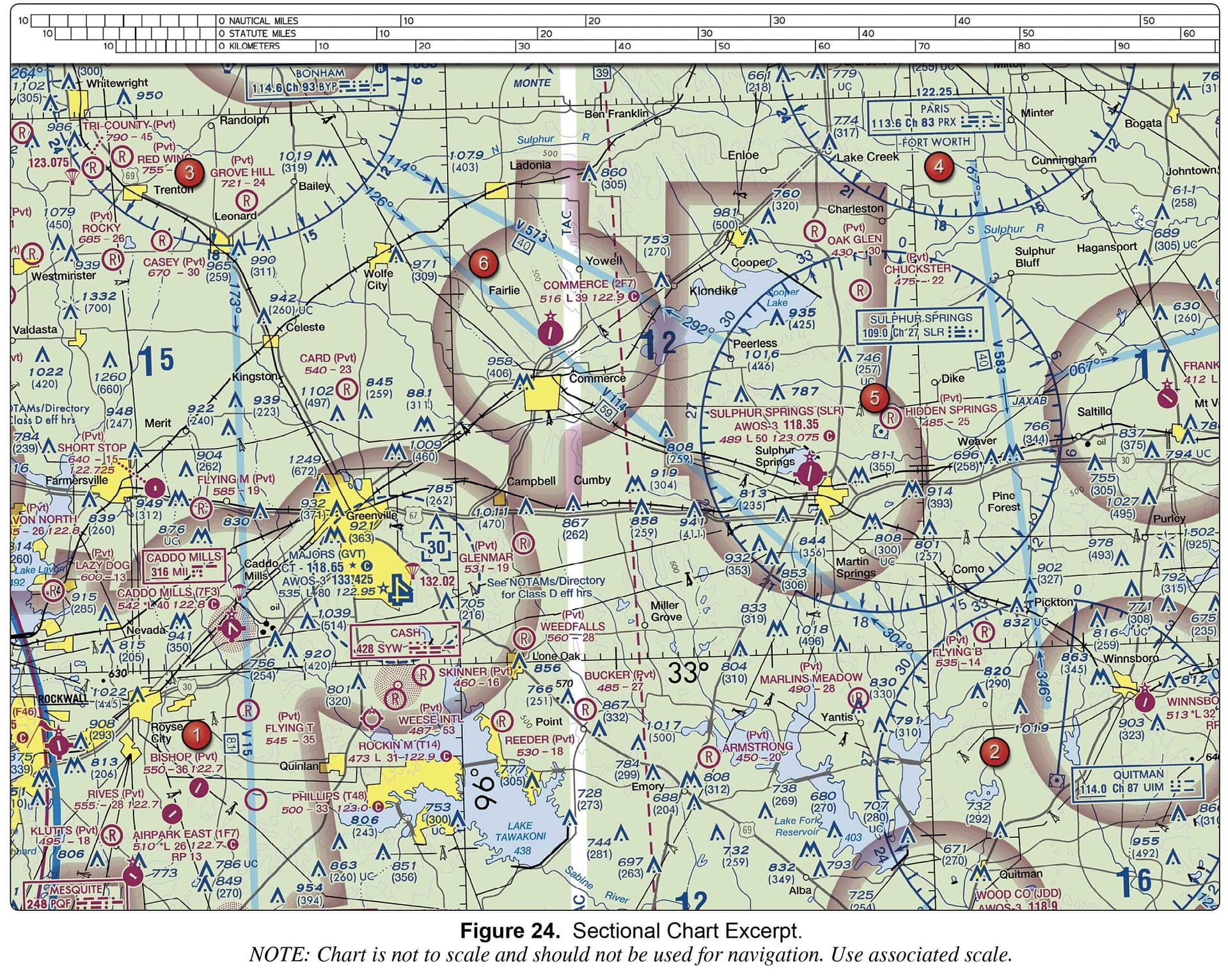
Refer to the legend for special use airspace phone number. This information is ...
UAV CampusAdministrator
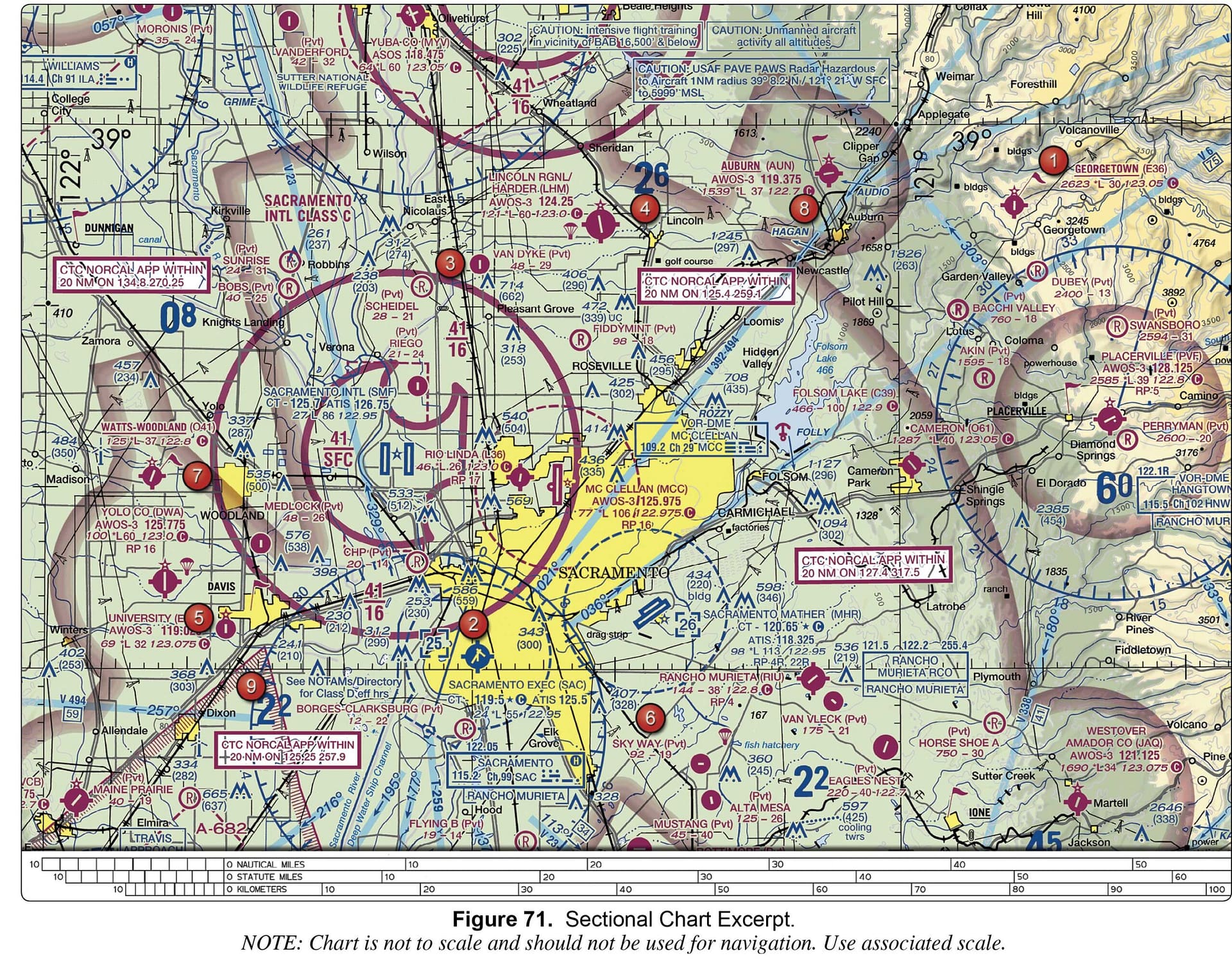
a privately owned airport restricted to use. an airport restricted to use by sport pilots only. a restricted military stage field within restricted airspace.
UAV CampusAdministrator
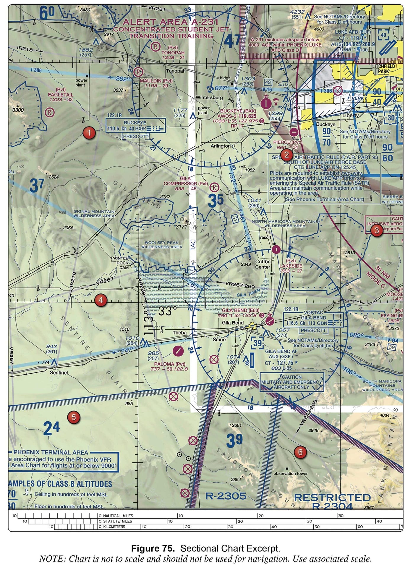
Class B. Class C. Class D.
UAV CampusAdministrator
a nonpublic-use airport. an airport restricted to use by private and recreational pilots. a restricted ...
UAV CampusAdministrator
the Notices to Airmen (NOTAM) publication. notes on the border of the chart. the Airport/Facility Directory section of the Chart Supplement.
UAV CampusAdministrator
Airports with control towers underlying Class C, D, and E airspace are shown in magenta. Airports with control towers underlying Class B, C, D, and E airspace are shown in blue. Airports with control towers underlying Class A, B, and ...
UAV CampusAdministrator
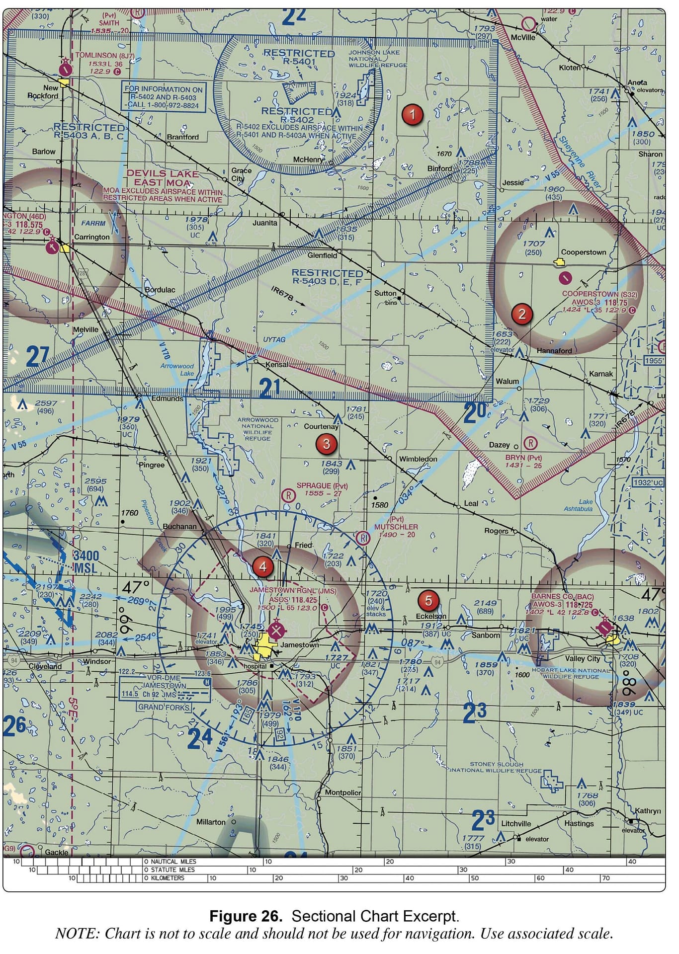
Class E airspace from the surface to 1,200 feet MSL. Class D airspace from the surface to the floor of the overlying Class E airspace. Class G airspace from the surface up to but not including 700 feet AGL.
UAV CampusAdministrator
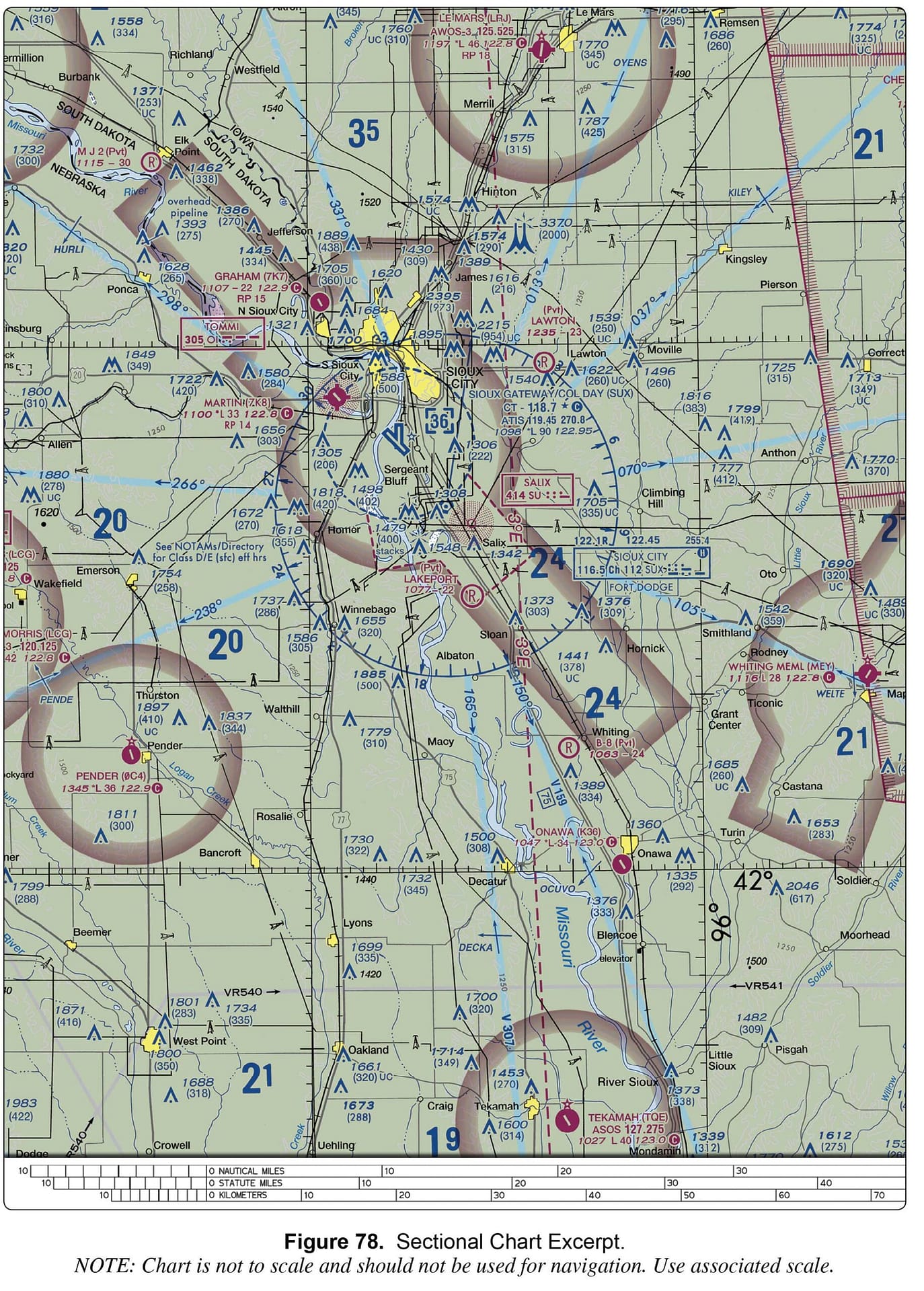
122.95 MHz. 118.7 MHz. 119.45 MHz.
3,000 feet MSL. 3,100 feet MSL. at the surface.